


RAIN STARTS LATE AFTERNOON: Morning lows start around the freezing mark, but will jump into the low-50s by Thursday afternoon. Warm southerly winds bring in moisture throughout the day, which could spark a few showers ahead of our main cold front as we go throughout late Thursday afternoon and the evening. We’re cloudy all day until then.

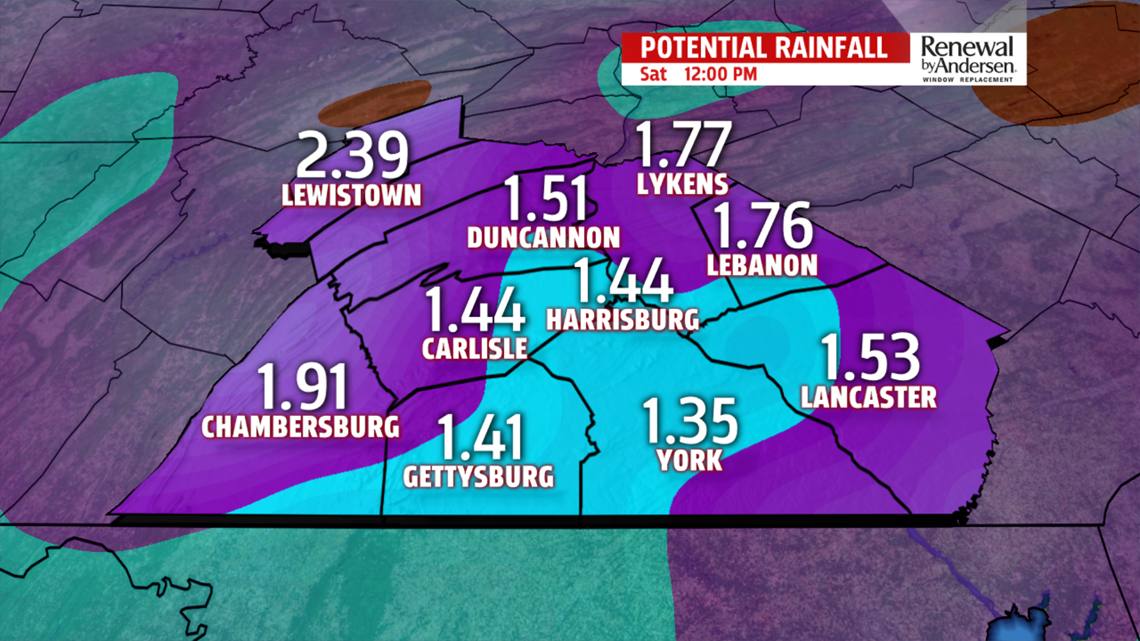
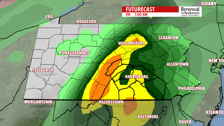
OFF-AND-ON SHOWERS FRIDAY: Temperatures drop with the clouds into the mid-to-upper 40s as rain fills in the entire area overnight into Friday morning. Highs reach the mid-to-upper 50s as waves of showers move into Central PA. We’ll get the occasional break, but the end of the week is overwhelmingly wet. More than 1″-1.5″ of rain is likely for most of the area, but we’ll see locally higher totals.

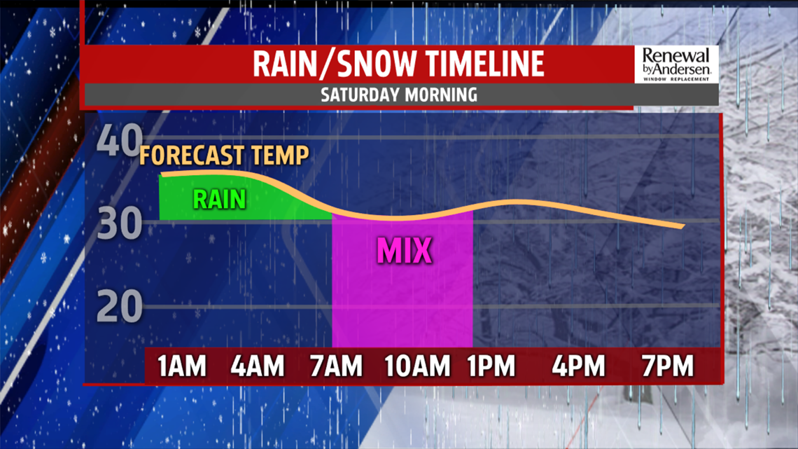
MIXING SATURDAY, GETTING COLDER: The high is close to midnight Saturday morning. Temperatures drop dramatically throughout the morning and into the early afternoon. We could see some mixing between rain/sleet/snow on Saturday morning as temperatures decline. Afternoon temperatures are cold with northwest winds at 10-15MPH. We keep the cold air finishing out the Weather Smart Forecast, with highs in the 20s and 30s.
Stay tuned for updates as we head towards the weekend. We’ll give you the information you need to be Weather Smart.
Have a good one!
-Meteorologist Bradon Long
