WHIPPING WINDS

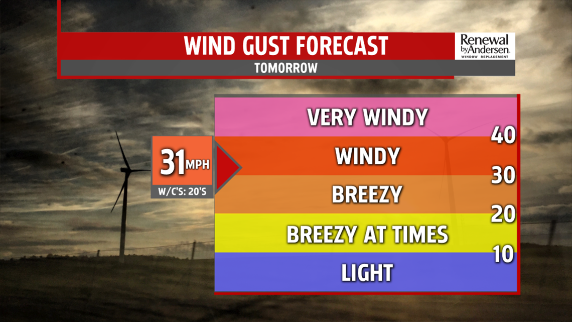
This evening gusty winds relax and cloud cover is slow to break up. Temperatures tumble through the 30s. Dress for wind chill values in the upper 20s. Morning lows are in the mid 20s. Sunshine is brief before clouds thicken. A few flurries are possible thanks to strong winds out of the northwest 10-20 MPH with gust near 35 MPH .

Afternoon temperatures slowly climb through the 30s. A few isolated spots could touch 40 but either way, we are dressing for wind chill values in the 20s. The breeze continues into Thursday. Ahead of a passing cold front, temperatures jump to the lower 40s. A few flurries or sprinkles are possible. It’s another cold shot for Friday. Readings expected to fall back to the 30s to near 40 degrees. Mostly cloudy skies and breezy conditions, will limit amount of sunshine. High pressure builds in overnight leading to positive changes for the weekend.
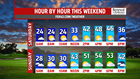
WEEKEND OUTLOOK
Expect more sunshine for Saturday. The brighter skies help to boost temperatures back into the upper 40s. There is still a light breeze. Skies are clear overnight into Sunday leading to a cold morning in the 20s. While we start with abundant sunshine for the second half of the weekend, a weak frontal boundary swings through by evening, producing cloud cover but at this point, it does not bring a shower threat. Readings are milder and more seasonable in the lower 50s.