

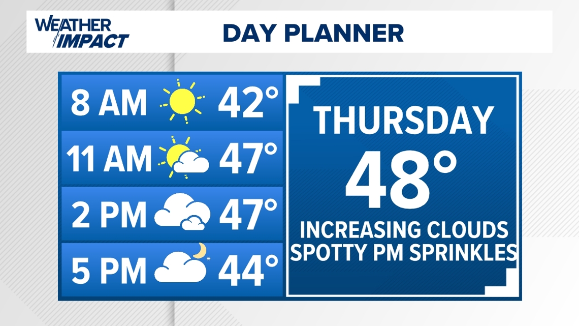
PENNSYLVANIA, USA — BECOMING COOLER & GUSTY: The showers and gusty downpours are now to our north and east this morning, however, roads will still be damp early so use caution! Some much cooler air wraps around a new low developing with many of us starting out Thursday in the upper 30s. For the first half of the day Thursday, it’ll be cool, but we are dry with morning sunshine leading to PM clouds and only a few spotty showers developing. A cooler afternoon with highs in the upper 40s to near 50. A new low near the NY/NJ border will have developed by Thursday evening, with cooler air continuing to usher in here in south-central PA. Winds will start to become breezy Thursday with gusts over 20 mph becoming possible. Overnight lows fall into the chilly mid 30s and feeling even cooler with the breeze!

Scattered snow showers will be possible, especially along and north of the turnpike, by Friday morning giving us the first flakes of the season for some. Little to no accumulation is likely early so expect some damp roads but not much of an impact to the morning commute! Light accumulation is possible in our higher elevations and perhaps a coating to a slushy mix on grassy surfaces and areas north and west of 81. Temperatures will be much cooler to end the work week with wind gusts to 30 mph possible, just adding to a chill in the air! Highs will struggle to get out of the chilly low 40s Friday and scattered morning snow showers will gradually change over to a mix of rain showers throughout midday. Clouds hang tough but those scattered showers will begin to taper through the evening. Gusty winds linger and overnight lows will drop in to the upper 30s to near 40 by Saturday morning!

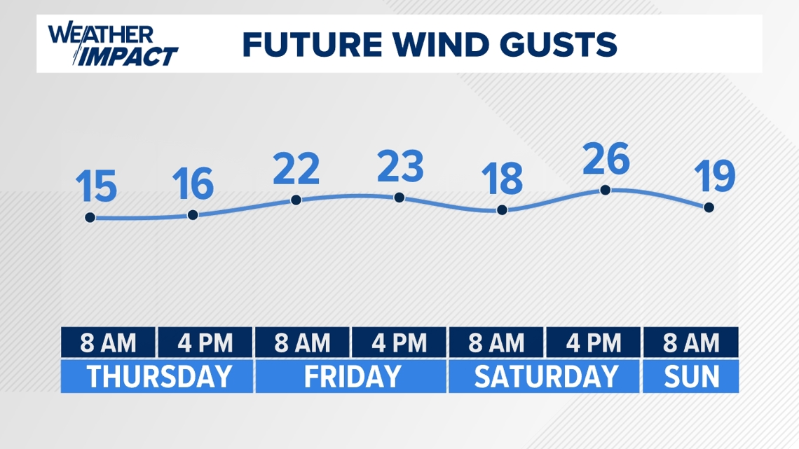
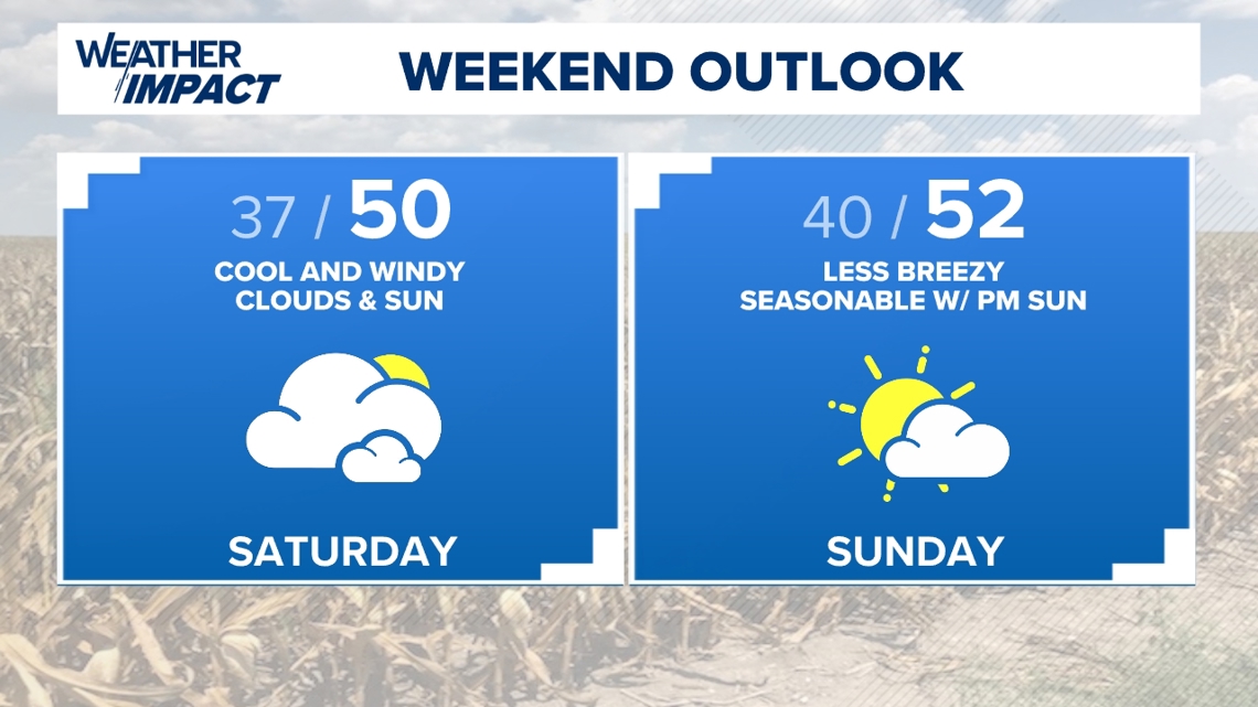
WEEKEND OUTLOOOK: A breezy and chilly start to the weekend is on tap as the low to our northeast slowly pushes off the New England coast. We’ll bring back a mix of clouds and sun Saturday with northwesterly winds staying gusty, up to 30 mph. A spotty Lake Effect sprinkle is possible, but we’re mostly dry through the weekend! Highs will be in the seasonably cool mid to upper 40s Saturday afternoon dropping into the mid to upper 30s by Sunday morning. Sunday, conditions will begin to gradually moderate to close the weekend! Clouds hang tough for the first half of the day, but winds will be less breezy with highs returning closer to normal, near 50 by the afternoon! High pressure gradually building in will keep mostly dry, less breezy and seasonable conditions heading into the new week.

SEASONABLE EARLY WEEK: Brief high pressure wedged in Monday will keep winds less breezy with temperatures moderating. Light winds and mostly clear skies to start the day, some patchy morning fog will be possible early with morning temps starting off in the low to mid 30s! Highs will be cool but seasonably pleasant in the mid 50s to start the week! A disturbance to our north will bring a spotty shower chance after sunset Monday and mainly before sunrise Tuesday. After being a few degrees above normal Winds will be a bit breezy and temps fall a bit by Tuesday with highs struggling to get out of the low 50s. A better shower chance and another cool-shot arrives around Thanksgiving!
Stay with FOX43 for the latest on your Weather Impact forecast! Have a great day!
-Meteorologist Grant Carlton