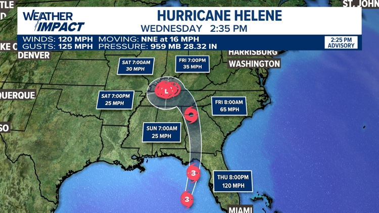
UNITED STATES, — Helene made landfall as a category 4 storm Thursday evening at 11:10 PM along Florida's Great Bend Region. The storm has lost intensity since then and will continue to do so as it moves north and then northwest.
Interactive Helene radar
Helene Pennsylvania impacts
We still expect some moisture to impact us here in Pennsylvania as a result of Helene. Helene's remnants will keep clouds and stray showers in the forecast today at times through the weekend.
You can stay up-to-date with your latest forecast for Central Pennsylvania here.