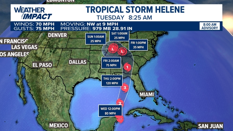
UNITED STATES, — Tropical Storm Helene is expected to intensify as it moves into the Gulf of Mexico through the end of this week.
Currently sitting at the strength of a Category 2 Hurricane, The National Hurricane Center has forecast the storm to become a major hurricane as it pushes toward the entire west Florida Coast, potentially making landfall as a Category 3 late week near Florida's Great Bend.
Several alerts have been posted in preparation for hurricane strength winds, life-threatening storm surge, and high rainfall rates that may lead to flash and regular flooding.
Storm surge looks highest for Florida's Great Bend with levels of up to 15 ft. possible.

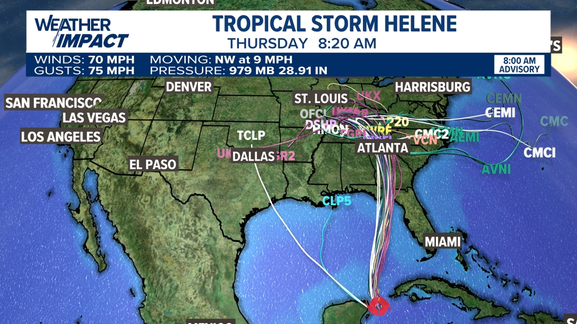
After the storm makes landfall in the U.S., it will gradually lose steam as it heads north and then northwest.
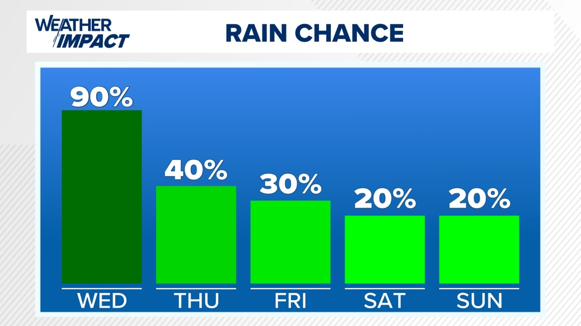
Even though the storm takes a big turn to the west, we still expect some moisture to impact us here in Pennsylvania as a result of Helene. The remnants of the storm will interact with another front in the atmosphere. This will keep clouds and stray showers in the forecast for Friday and possibly through the weekend.

You can stay up-to-date with your latest forecast for Central Pennsylvania here.